
Polylines and Lines
The polylines and lines annotation for mapping, driving or pose detection

Join our Platform and start your Polylines project
Polylines and Lines: Deep Learning or Mapping
How it Works
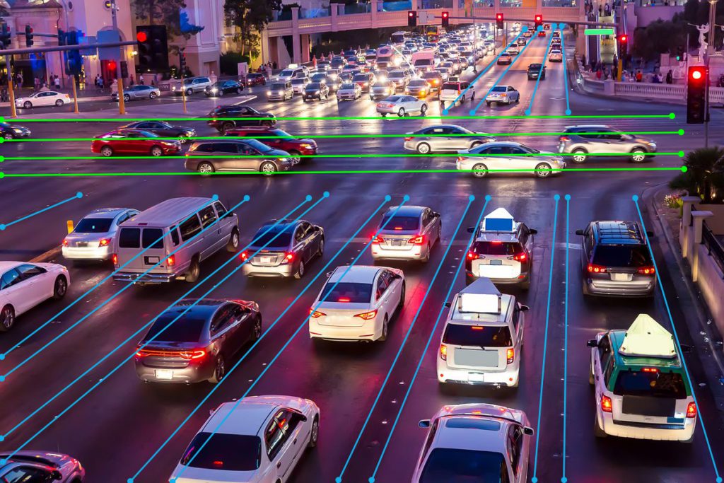
Polylines and Lines are straight and curved lines as annotations.
* Speed, precision, and techniques. Curved lines require more efforts, but from the basics of geometry it is quite easy to draw the straight lines, if the tools and techniques are set. Typically, lines and splines are used in autonomous driving, route and roads, sidewalks, as well as pose detection or face recognition.
* Geospatial. Mapping application, drone routes and roads, trajectories, and driving paths require extensive lines annotation, and there needs to be a special team training to serve the use cases well, which we mastered at TaQadam.
The only difference between the high quality polygon annotation and lines is the output format, as lines avoid spaces and noise in the image. It is open, it is not a geometrically defined form. But the use cases for this product are so unique and difficult, that good machine learning models can be developed with data built by a specialized teams.
Polylines and Lines
Why TaQadam: We Make Visual Data AI-Ready
Image Annotation company with a complete solution on AI data training:
Image annotation tool, Data Management Platform and Trained Teams
- Quality Assured Annotation
- Managed Teams
- Standard or Custom Data Output
- Industry Specific Expertise
- Data Management Platform
- No Project Management Fee
- Security and Non-Disclosure